Hand-drawn map of all of Iceland.
This project is now finished.
raised of €10,300 goal
days to go
Backers

{{ reward.description }}
{{ reward.description }}
To add milestones and tasks to your plan, please send them via e-mail to info@karolinafund.com. Tell us which tasks you have already finished (checked) and which ones are left.
Showing what the plan is for your project helps build trust with potential backers.
This is what map designer Smári has to say about the project:
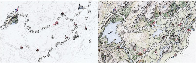
“The idea is to publish a map that I have been drawing for the past two and a half years. It shows the entire country. The main tourist attractions are drawn (waterfalls, churches, etc.) BUT also the land between them. The map shows landscapes as much as destinations. Small "portraits" of all the country's towns and villages are arranged in the sea around the country. The map will be folded in gift boxes and rolled up in cylinders. Its size will be A0. The goal is for tourists to be able to buy it in bookstores and elsewhere. This is the first map in a series of maps that I hope I will manage to draw in my lifetime.”
But who is this Smári and why did he start drawing this map?
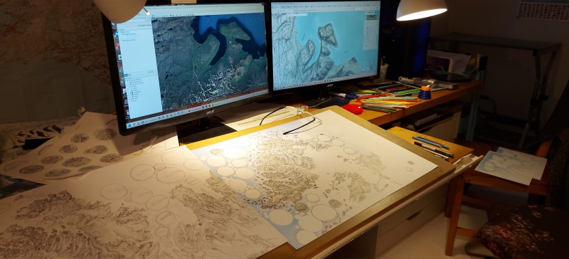
The life of the artist Ómar Smári Kristinsson developed in such a way that he started drawing maps. Both as a weather observer in Æðey and as a shopkeeper in Landmannalaugar, he found himself having to explain the same things many times. He knows that pictures say more than a thousand words and this is no less true of maps. Many people became aware of his ability to share information on maps and they took advantage of it. Before long, Smári had drawn a whole lot of maps of municipalities, urban areas and all kinds of places, far and wide across the country. These are handmade maps that are more related to art than science. In them, poetic license is dominant and it is used sparingly or liberally, depending on what the subject requires. It all depends on what story is to be told and what information is to be conveyed.
Smári has traveled extensively throughout the country. He tries to personally get to know all the places he draws and get in closer contact with them. Then he is more likely to be able to make a convincing drawing of them. He has also cycled widely throughout the country. This slow mode of travel also provides a personal connection to the country. The cycling trips are mainly related to the creation of his Biking Books. They contain many maps. The book publication has given Smári an insight into the world of publishing and the business that goes with it.
Now the time has come for Smári to combine his experience in cartography and publishing. He drew most of the maps for someone else. He now draws the Beautiful Tourist Map of Iceland for himself, but he also hopes that it will appeal to many people. He hopes that tourists will fall for it and buy it in large quantities.
As in the Biking Book publication, Smári would be inoperative and unable to accomplish anything if he were not well married. Nína Ivanova has more or less handled the layout, design and technical implementation of most of Smári's works over the years. She is also the artist's main motivator and critic. She is a visual artist herself. She is of course part of the team for this project.
Is there anything special about this map?
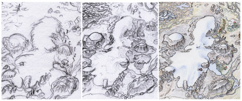
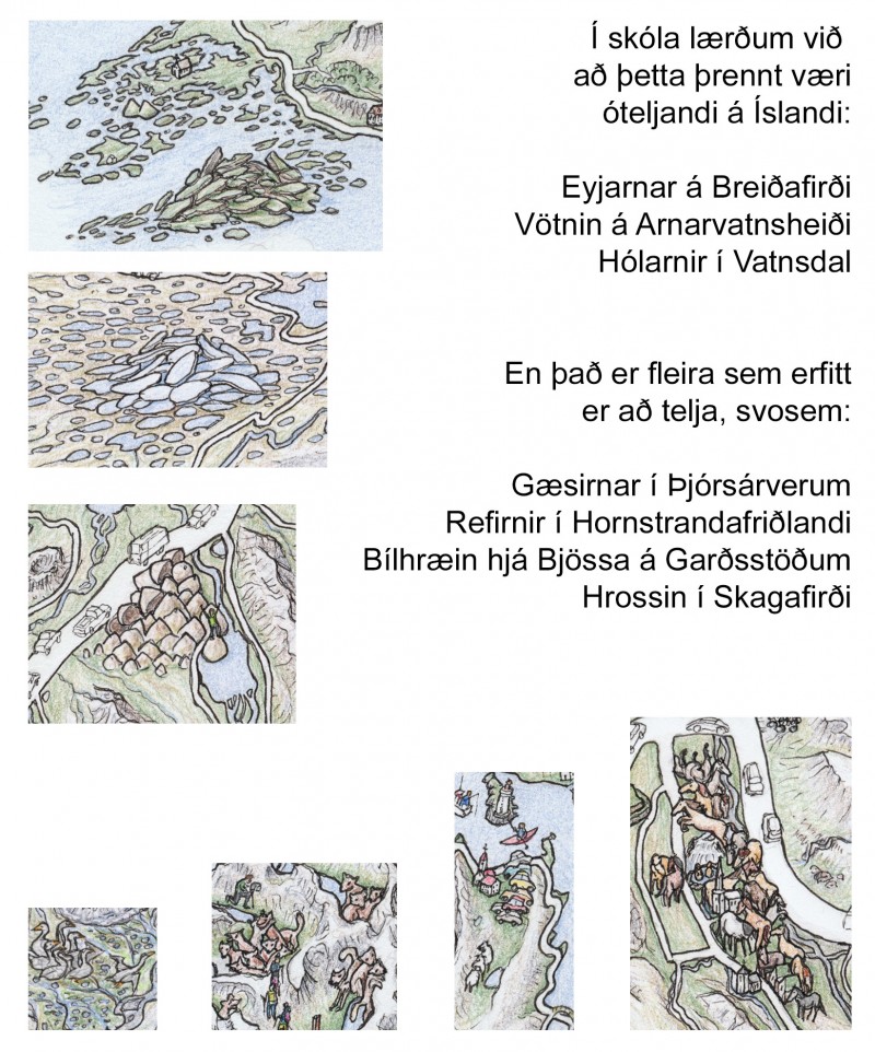
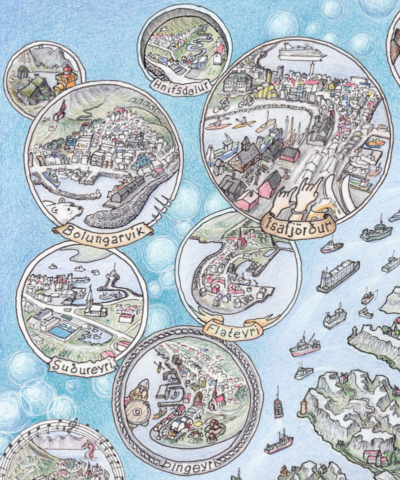
Most tourist maps that show destinations show little more than the outlines of the country and individual images put on it. For Smári, the country and the journey through it are much more than destinations. The uniqueness of Iceland is the landscape itself. It is divided into mountain ranges, deserts, glaciers, heathlands and so on. Smári shows these phenomena, although he certainly has to pick and choose; it is not possible to put every hill and pond on a map, as some have to be exaggerated at the expense of others. Yet Smári managed to cram over 300 churches and 100 lighthouses onto the map. Many churches, several lighthouses and a whole lot of other features that tourists want to see are within urban areas. There is not room for them all on the map where the urban areas in question are. That is why Smári choose to make a picture of every town and village in the country. He arranges these miniature images in the sea around the country.
People who see this map get a better idea of ??the appearance and structure of the country than ordinary tourist maps can give them. Real maps with the correct proportions cannot give such a view of the country either. On Smári´s map, the large rivers are large, while the smaller ones are small or not shown at all. The roads are shown widest and have the most cars on them where the traffic is heaviest. In an instant, the user of the map sees where the most traffic is, the main rivers, the size and location of urban areas and the type of landscape. But it is also possible to immerse oneself in the details: hikers on the country's most popular hiking trails, birdlife at the bird cliffs, wild and domestic animals here and there where they can be expected, statues, artwork, hot springs, cairns...
Continuation?
This is just a tourist map. The next maps will have volcanoes, elves, trolls, monsters, flowers, or events from Icelandic history. Smári plans to continue cycling and reach old age, doing so. Then he can draw a lot of maps before he dies. This is just the first step in publishing the Beautiful Maps of Iceland.
This project is now finished.
raised of €10,300 goal
days to go
Backers
{{ reward.description }}
{{ reward.description }}
Karolina Fund ehf © 2026 | Kt: 460712-1570 | VAT: 111464 | Bjargargata 1, 102 Reykjavík, Iceland